Россия, Магнитогорск


СДЕЛАЙТЕ СВОИ УРОКИ ЕЩЁ ЭФФЕКТИВНЕЕ, А ЖИЗНЬ СВОБОДНЕЕ
Благодаря готовым учебным материалам для работы в классе и дистанционно
Скидки до 50 % на комплекты
только до
Готовые ключевые этапы урока всегда будут у вас под рукой
Организационный момент
Проверка знаний
Объяснение материала
Закрепление изученного
Итоги урока

Была в сети 19.12.2022 15:48

Хмелевская Лариса Петровна
Учитель иностранного языка
Местоположение
Специализация
Презентация "Рельеф, климат англоговорящих стран и России "(подготовка к ЕГЭ)
Категория:
Английский язык
29.09.2020 19:57

Просмотр содержимого документа
«Презентация "Рельеф, климат англоговорящих стран и России "(подготовка к ЕГЭ)»

Рельеф, климат англоговорящих стран и России

Geography
- Great Britain is a state in the northwestern part of Europe. The country is located in the British Isles and includes England, Scotland, Wales and Northern Ireland. It also includes the Isle of Man and the Normans.
- The English Channel, Pas-de-Calais and the North Sea separate the UK from the mainland. From the north and west the shores are washed by the waves of the Atlantic Ocean. Along the western borders is the Irish Sea. The area of the country is 244.1 thousand square km.

- The relief of the United Kingdom is extraordinary. In the northern and western parts of the country dominates the mountainous dissected terrain. In the central and southeastern regions, large areas are occupied by heaths and elevated plains. The highest point of the country is located in Scotland in the city of Ben Nevis and is 1343 meters. Northern Ireland, which is part of the UK, is on the western extension of the Scottish mountains and occupies the country's second largest island. Its mountainous terrain is divided by the Northern Canal.

- In the UK, many bays, coves and peninsulas. The sea off the coast reaches a depth of 90 meters. The warm current of the Gulf Stream, passing here, heats the air and water, thereby making the climate here warmer than in other northern countries.
- The following rivers flow across the country: the Severn (310 km), the Clyde (170 km), the Tyne (58 km), Trent (274 km), the Thames (332 km).
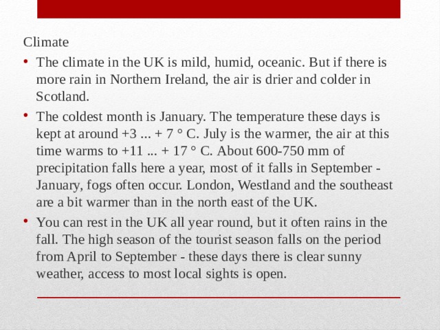
Climate
- The climate in the UK is mild, humid, oceanic. But if there is more rain in Northern Ireland, the air is drier and colder in Scotland.
- The coldest month is January. The temperature these days is kept at around +3 ... + 7 ° С. July is the warmer, the air at this time warms to +11 ... + 17 ° С. About 600-750 mm of precipitation falls here a year, most of it falls in September - January, fogs often occur. London, Westland and the southeast are a bit warmer than in the north east of the UK.
- You can rest in the UK all year round, but it often rains in the fall. The high season of the tourist season falls on the period from April to September - these days there is clear sunny weather, access to most local sights is open.

География России
- Рельеф России весьма разнообразен: представлены широкие равнины, плоскогорья, высокие и средневысотные горы. Преобладающими из крупных форм рельефа являются равнины.
- Около трети территории занимают горы. Они обрамляют равнины на юге, востоке и северо-востоке страны.
- Высшая точка России и Европы – гора Эльбрус на Кавказе достигает 5642 м, а побережье Каспийского моря лежит на 28 м ниже уровня Мирового океана.
- Территория страны, особенно азиатской ее части, имеет общее понижение к северу, о чем свидетельствует направление течения большинства крупных рек.
- Горные сооружения обрамляют равнины, причем основная часть гор сосредоточена на юге Сибири, северо-востоке и востоке страны.
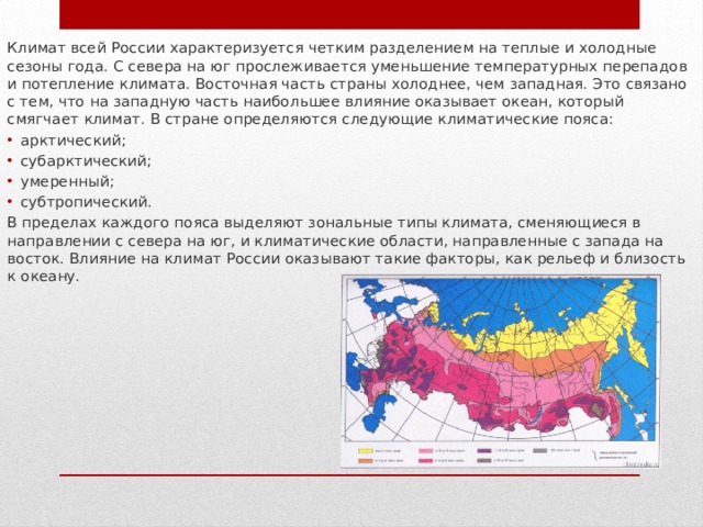
Климат всей России характеризуется четким разделением на теплые и холодные сезоны года. С севера на юг прослеживается уменьшение температурных перепадов и потепление климата. Восточная часть страны холоднее, чем западная. Это связано с тем, что на западную часть наибольшее влияние оказывает океан, который смягчает климат. В стране определяются следующие климатические пояса:
- арктический;
- субарктический;
- умеренный;
- субтропический.
В пределах каждого пояса выделяют зональные типы климата, сменяющиеся в направлении с севера на юг, и климатические области, направленные с запада на восток. Влияние на климат России оказывают такие факторы, как рельеф и близость к океану.

Тип климата
Регионы
Арктический
Побережье и острова Северного Ледовитого океана
Субарктический
Полярный круг
Умеренный
Центральная Россия, Западная Сибирь, Дальний Восток
Субтропический
Побережье Черного моря, Кавказские горы


Вебинар для учителей

Свидетельство об участии БЕСПЛАТНО!